|
||
|
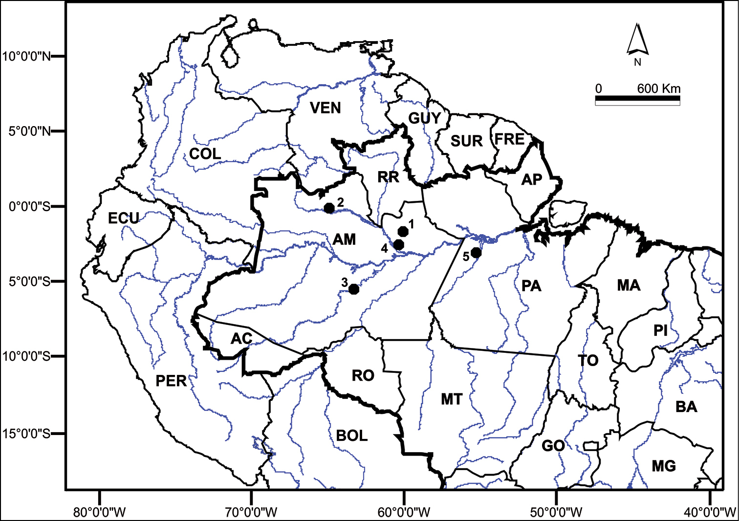
Map of the Brazilian Amazon, indicating the collection sites. The left and right banks of the following Amazonas state rivers were sampled: 1 Jatapú (near the city of São Sebastião do Uatumã - 0°50’ to 1°55'S; 58°50’ to 60°10'W) 2 Negro (near the city of Santa Isabel do Rio Negro - 0°24.4'N; 65°1.017'W) 3 Purus (near the city of Tapauá - 05°42.183'S, 63°13.967'W) 4 Cuieiras (02°47'S, 60°27'W) 5 Tapajós (03°21.283'S, 55°11.733'W). BOL = Bolivia, PER = Peru, ECU = Ecuador, COL = Colombia, VEN = Venezuela, GUY = Guyana, SUR = Suriname, FRE = French Guyana, RR = Roraima, AP = Amapa, AM = Amazonas, PA = Para, RO = Rondonia, AC = Acre, MA = Maranhão, PI = Piaui, TO = Tocantins, BA = Bahia, MT = Mato Grosso, GO = Goias, MG = Minas Gerais. |